The Middle East Navigation Aids Service (MENAS) has signed an agreement with the Bahrain Ports and Maritime Affairs (PMA) to remove and replace three abandoned light beacons in the Northwest of Bahrain and to survey all Aids to Navigation (AtoNs) in Bahraini waters.

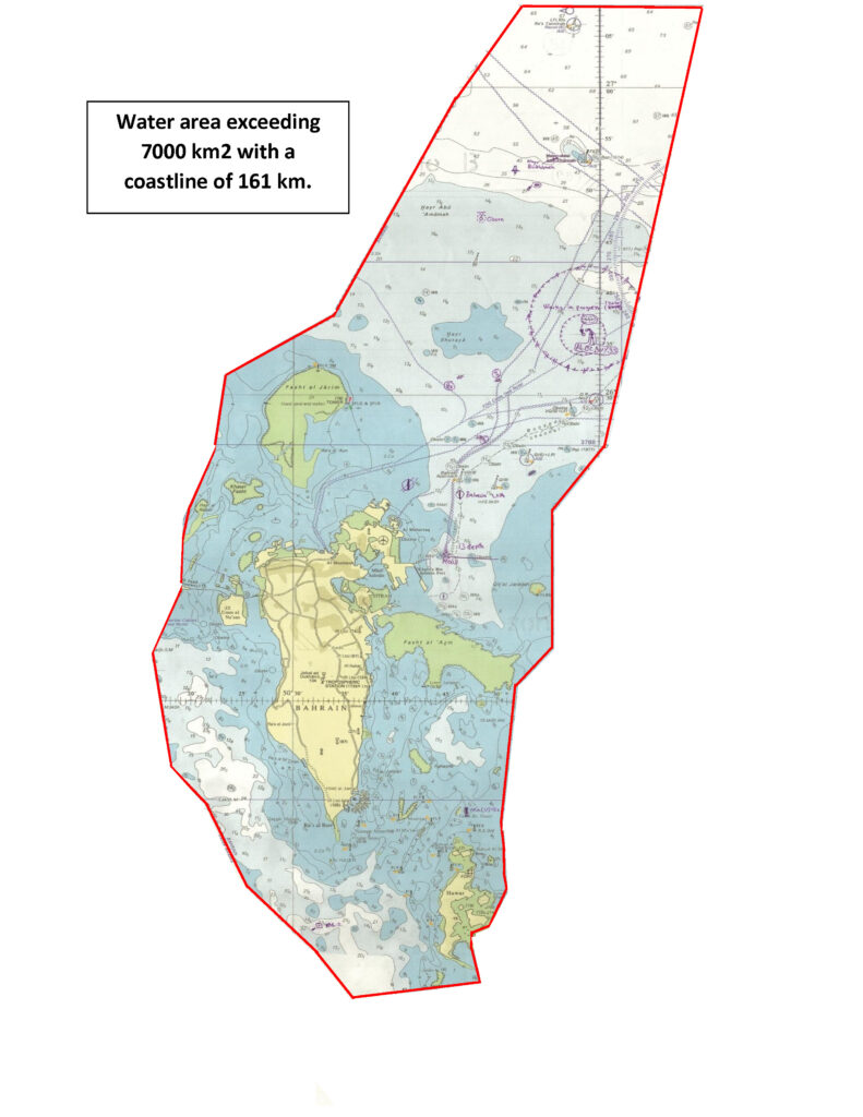
The survey, which should take up to eight months, will cover all main channels as well as the approaches to Bahrain – its islands, reefs, all inner channels, private jetties and fisheries harbours, containing in total more than 400 AtoNs (light beacons and buoys) covering a water area of nearly 7000 km2 with a coastline of 161 km.
Operating from its main base in Bahrain and a support base in Abu Dhabi, MENAS, a branch of the International Foundation for Aids to Navigation (IFAN), owns and maintains an extensive network of buoys, lighthouses and Racons, mostly located in remote areas more than 12 nautical miles from the shore, and generally in hazardous areas such as narrow waterways leading to main ports.
According to Peter Stanley, CEO of MENAS and IFAN, the survey will help to improve the provision of an AtoN service in Bahraini waters in meeting the needs of the mariner while optimising and specifying the correct quantity and type of AtoN needed in each area, based on the volume of traffic and the degree of risk. “Importantly, it will help the PMA and other owners in maintaining the service of the AtoNs to the necessary standard,” he said.


Mahdi Al Mosawi, MENAS General Manager, added: “We’re delighted to be working on this important project to promote safety in the region. MENAS is proud to be working for the PMA and supporting the Bahraini government in maintaining safe navigable waters around the islands.”
Survey Method Notes:
The team holds International Association of Marine Aids to Navigation and Lighthouse Authorities (IALA) AtoN and risk assessment certificates. MENAS will be using two IALA risk assessment tools, SIRA and IWRA, and the engineers will visually inspect and evaluate the condition, efficiency and effectiveness of each AtoN, before issuing a certificate containing detailed information of the AtoN as well as any recommendations.
MENAS has divided Bahraini waters into nine zones and will evaluate AtoNs in each zone through that AtoN’s usage factor. This will provide mariners with the necessary guidance either marking a channel or isolating danger or keeping the vessels out of a particular danger zone.
The Survey Plan will cover factors used to determine the risk to mariners; vessels involved, facilities ashore as well as the marine environment. This is based on the principle that a failure of a single AtoN unit should not significantly increase the risk to safe navigation. A Level of Service statement (LOS), implemented for each zone, will define the maximum operational capability of an AtoN within that zone.
The final report will plot traffic density for each area in according to the vessel type and size and will measure the probability of risk. It will calculate the availability of AtoNs and optimise the quantity of AtoN required for each area. It will categorise AtoNs upon navigational significance using IALA Categorization system Cat 1 (vital), Cat 2 (Important), Cat 3 (Necessary) or decide whether they are to be removed, and the report will ensure that the correct AtoN is used in terms of type, height, shape, light characteristics, and range.


